News
‘Geofencing’ helps reduce human-elephant conflict in Sri Lanka
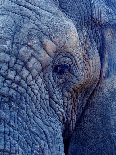
Scientists put a radio collar on Panu Kota on June 1, 2019. Since then, the elephant’s current location details are transmitted through the GPS coordinates every four hours via a satellite communication system to wildlife authorities. (File Photo:
Jennifer Latuperisa-Andresen/Unsplash)
- In the past two decades, Sri Lankan scientists have pioneered an effort to track the movements of more than 100 elephants using GPS satellite tracking collars.
- Panu Kota, one of the last two remaining elephants (Elephas maximus maximus) living in the UNESCO World Heritage Sinharaja Forest Reserve, was GPS satellite collared in June 2019, enabling authorities to receive a signal whenever the roaming elephant enters nearby villages and to make timely interventions to reduce confrontations between the transgressing elephant and villagers.
- Data generated through the radio tracking system has shown that elephant translocations have failed because elephants regularly return to their home range, requiring new solutions to mitigate human-elephant conflict.
- Authorities say the elephant tracking data can help develop mechanisms to minimize human-elephant conflict by shedding light on the animals’ movements and identifying areas not often visited by elephants for development and agriculture.
COLOMBO, Sri Lanka — As the chief veterinary surgeon at the Department of Wildlife Conservation (DWC), Tharaka Prasad is probably the only Sri Lankan to receive messages from an elephant (Elephas maximus maximus). Known as Panu Kota, a male elephant roams the Sinharaja Forest Reserve in southern Sri Lanka, and each time he draws close to a nearby village, his collar emits a beep that offers locational information to Prasad.
Scientists put a radio collar on Panu Kota on June 1, 2019. Since then, the elephant’s current location details are transmitted through the GPS coordinates every four hours via a satellite communication system to wildlife authorities.
Through this mechanism, the department’s team was able to mark a virtual boundary known as a geofence around the adjacent villages the elephant was known to enter. “Whenever Panu Kota crosses any of the virtual boundaries, a message transmits itself, enabling us to easily identify its geolocation and the closest village so our teams can intervene swiftly,” Prasad, who monitors the elephant’s movements from DWC headquarters, told Mongabay.
If the elephant remains inside the village, Prasad informs ground staff at DWC’s Rakwana office, the station closest to the range of the elephant, so they can act fast before the animal comes into conflict with the villagers.
In Rakwana, ranger Kapila Ranukkanda and his team are ready to mobilize whenever the elephant enters a village to prevent any conflict with the villagers. Panu Kota and Loku Aliya, which means “big elephant,” are two males that have killed a dozen villagers in past encounters. The villagers protested on several occasions, demanding translocation of these two Sinharaja elephants. But environmentalists have opposed moving the elephants, noting that these were the last remaining elephants from a herd that once roamed the rainforests in this part of Sri Lanka.
The new technology has also helped the DWC to pinpoint the boundaries of Panu Kota’s entire home range, information that is important for managing the elephant. Based on eyewitness accounts and DWC records, Ranukkanda previously came up with a rough map showing the movement patterns of the two elephants. But more than a year of the radio collar data has helped him to validate and make adjustments to the perceived home range.
It is estimated that Sri Lanka has around 6,000 elephants, At 65,610 square kilometers (25,330 square miles), the island has the highest density of Asian elephants (Elephas maximus maximus). About 70% of Sri Lanka’s elephants live outside DWC’s protected areas, creating a natural arena for intense human-elephant conflict that annually kills about 400 elephants and 70 people.
Identifying homesick elephants
Prithiviraj Fernando, an Asian elephant conservation and management specialist who leads the Centre for Conservation and Research (CCRL), pioneered Sri Lanka’s first effort in radio tracking the elephants. The CCRL team, in collaboration with the DWC, started their mission using VHS collars to check migration patterns of Sri Lankan elephants in 1995. They found that the animals have home ranges of around 200 km2 (77.2 mi2) and do not migrate long distances through elephant corridors as previously believed.
The next breakthrough in radio tracking elephants came with the introduction of collars with GPS units. GPS determines the location of a signal using a satellite network, enabling the new collars to obtain accurate location information for an elephant, day and night.
“This way, we can collect extremely precise data on elephant movements at four-hour intervals, and we could find answers for many questions that are relevant to management of elephants,” Fernando told Mongabay.
The GPS radio collars also taught the researchers that translocations and elephant drives are not successful in mitigating human-elephant conflict.
Homey was an elephant in the habit of making frequent visits to a massive garbage dump in Hambantota in Sri Lanka’s deep south. Homey was the first translocated elephant to be GPS collared by CCRL in 2006. After two translocations from Hambantota to Yala National Park’s Block II, he walked back home within days. Next, he was translocated from Hambantota to Udawalawe, and yet again, he returned. After that, he was translocated to Maduru Oya and came back halfway. Ultimately, Homey was shot and killed close to Maduruoya, as a result of human-elephant conflict. Homey killed at least two people during translocations but did not kill anyone while he was in Hambantota. DWC officers counted more than 300 gunshot injuries in his body.
“We tracked more elephants using the radio collar method, and the generated data have shown beyond any doubt that translocations are impractical as elephants do come back. Some wander over huge areas creating more problems, and others settle down in new areas but cause conflicts there,” Fernando said.
Through the radio collar data, Fernando and the team also discovered that elephant drives do not mitigate the conflicts caused by some elephants. Instead, they often impact entire herds that do not cause problems that lead to human-elephant conflict. To make matters worse, the herds driven out of their home ranges and restricted to protected areas by electric fences often starve to death. “Some of our radio-collared bull elephants break electric fences located inside forest areas at will, but herds rarely do that,” Fernando said.
Guiding the development agenda
Unplanned development projects are exacerbating human-elephant conflict in Sri Lanka, Fernando said. “Radio collared data has the ability to guide development initiatives by avoiding areas where potential for conflict is high and divert development to safer areas, minimizing the potential for conflict,” he added.
CCRL has conducted studies proving the effectiveness of radio-tracked data on at least four instances.
In 2011, a banana plantation was proposed along the borders and within Somawathiya National Park in northcentral Sri Lanka. The company defended the plans, arguing that the area has less elephant movement. But Fernando’s radio tracking data proved the plantation area was heavily utilized by elephants, which eventually resulted in the abandonment of the proposed plantation.
The highpoint of using GPS technology is that a new study provided data supporting a proposed managed elephant range (MER) in Mattala, Hambantota, in southern Sri Lanka. To develop Hambantota, the Sri Lankan Government earmarked the entire area around the Mattala International Airport (MIA) for development. But Fernando’s presentation based on elephant tracking data to the assessment team resulted in changes to the zoning plan to accommodate elephant needs with the inclusion of a MER.
Despite these efforts, this MER hasn’t yet been declared.
[This story was first published by Mongabay. Problem pachyderms? ‘Geofencing’ helps reduce Sri Lanka’s human-elephant conflict]